Log in
All resources
Create a design
417 Free Artworks of German Language Maps
bibliothèque nationale de france
carte generale du tres-haut, tres-puissant et tres chrestien royaume de france
topographisch, oeconomisch und militaerische charte von mecklenburg, schwerin und ratzeburg
topographisch, oeconomisch und militaerische charte des herzogthums mecklenburg schwerin and des fürstenthums ratzeburg - schmettau
baroque
maps by matthäus merian
matthäus merian
eran laor cartographic collection
willem albert bachiene
maps by willem and johannes blaeu
eran laor cartographic collection
emanuel bowen
maps of freiberg by braun & hogenberg
bibliothèque nationale de france
maps of oberwesel by braun & hogenberg
maps of boppard by braun & hogenberg
dr. wilh. junker's reisen in afrika 1875-1886
1880s maps of sudan
1794 maps of the holy roman empire
english-language maps of europe
1780s maps of the balkans
carl schütz
eran laor cartographic collection
willem albert bachiene
maps by john cary
1799 maps
17th-century maps of london
baroque
old maps of groningen (city)
baroque
maps of werden by braun & hogenberg
maps of essen by braun & hogenberg
maps by matthäus merian
baroque
history of schwäbisch hall
baroque
gottfried christian pingeling
1745 maps of hamburg
eran laor cartographic collection
evert maaskamp
sanson maps of the circles of germany
bibliothèque nationale de france
sanson maps of the circles of germany
bibliothèque nationale de france
maps by jakob van der schley
old maps of stralsund
old maps of utrecht (city)
baroque
17th-century maps of maastricht
baroque
old maps of emmerich am rhein
baroque
1640s maps of the netherlands
maps by nicolaes visscher i
17th-century maps of transylvania
maps by willem and johannes blaeu
maps of bratislava by braun & hogenberg
bibliothèque nationale de france
maps of schwäbisch hall by braun & hogenberg
bibliothèque nationale de france
eran laor cartographic collection
willem albert bachiene
eran laor cartographic collection
claes jansz. visscher (ii)
maps of paris from the david rumsey historical map collection
maps of paris by caspar merian
johann stridbeck the younger
old maps of the tyrol
waldenburg, switzerland
pierre pertuis in art
17th-century maps of carmarthenshire
17th-century maps of pembrokeshire
gustav freytag (cartographer)
old maps of karlovy vary
old maps of whole wales (alone)
1670s maps of wales
17th-century maps of the holy roman empire
maps by pieter van der keere
maps by matthäus merian
baroque
maps by matthäus merian
baroque
maps of görlitz by braun & hogenberg
bibliothèque nationale de france
eran laor cartographic collection
willem albert bachiene
maps by willem and johannes blaeu
bibliothèque nationale de france
maps of gdańsk by braun & hogenberg
bibliothèque nationale de france
maps of neuf-brisach city walls
leonhard christoph sturm
dillingen an der donau
baroque
17th-century maps of the isle of man
maps by willem and johannes blaeu
eran laor cartographic collection
willem albert bachiene
maps by willem and johannes blaeu
old maps of westmorland
topographisch, oeconomisch und militaerische charte des herzogthums mecklenburg schwerin and des fürstenthums ratzeburg - schmettau
topographisch, oeconomisch und militaerische charte von mecklenburg, schwerin und ratzeburg
topographisch, oeconomisch und militaerische charte des herzogthums mecklenburg schwerin and des fürstenthums ratzeburg - schmettau
topographisch, oeconomisch und militaerische charte von mecklenburg, schwerin und ratzeburg
topographisch, oeconomisch und militaerische charte des herzogthums mecklenburg schwerin and des fürstenthums ratzeburg - schmettau
topographisch, oeconomisch und militaerische charte von mecklenburg, schwerin und ratzeburg
topographische karte der gegenden wiens... - m. ragginger, del... - btv1b530275792
tranquillo mollo
topographisch, oeconomisch und militaerische charte des herzogthums mecklenburg schwerin and des fürstenthums ratzeburg - schmettau
topographisch, oeconomisch und militaerische charte von mecklenburg, schwerin und ratzeburg
topographisch, oeconomisch und militaerische charte des herzogthums mecklenburg schwerin and des fürstenthums ratzeburg - schmettau
topographisch, oeconomisch und militaerische charte von mecklenburg, schwerin und ratzeburg
topographisch, oeconomisch und militaerische charte des herzogthums mecklenburg schwerin and des fürstenthums ratzeburg - schmettau
topographisch, oeconomisch und militaerische charte von mecklenburg, schwerin und ratzeburg
topographisch, oeconomisch und militaerische charte des herzogthums mecklenburg schwerin and des fürstenthums ratzeburg - schmettau
topographisch, oeconomisch und militaerische charte von mecklenburg, schwerin und ratzeburg
topographisch, oeconomisch und militaerische charte des herzogthums mecklenburg schwerin and des fürstenthums ratzeburg - schmettau
topographisch, oeconomisch und militaerische charte von mecklenburg, schwerin und ratzeburg
topographisch, oeconomisch und militaerische charte des herzogthums mecklenburg schwerin and des fürstenthums ratzeburg - schmettau
topographisch, oeconomisch und militaerische charte von mecklenburg, schwerin und ratzeburg
topographisch, oeconomisch und militaerische charte des herzogthums mecklenburg schwerin and des fürstenthums ratzeburg - schmettau
topographisch, oeconomisch und militaerische charte von mecklenburg, schwerin und ratzeburg
topographisch, oeconomisch und militaerische charte des herzogthums mecklenburg schwerin and des fürstenthums ratzeburg - schmettau
topographisch, oeconomisch und militaerische charte von mecklenburg, schwerin und ratzeburg
topographisch, oeconomisch und militaerische charte des herzogthums mecklenburg schwerin and des fürstenthums ratzeburg - schmettau
topographisch, oeconomisch und militaerische charte von mecklenburg, schwerin und ratzeburg
topographisch, oeconomisch und militaerische charte des herzogthums mecklenburg schwerin and des fürstenthums ratzeburg - schmettau
topographisch, oeconomisch und militaerische charte von mecklenburg, schwerin und ratzeburg
topographisch, oeconomisch und militaerische charte des herzogthums mecklenburg schwerin and des fürstenthums ratzeburg - schmettau
topographisch, oeconomisch und militaerische charte von mecklenburg, schwerin und ratzeburg
topographisch, oeconomisch und militaerische charte des herzogthums mecklenburg schwerin and des fürstenthums ratzeburg - schmettau
topographisch, oeconomisch und militaerische charte von mecklenburg, schwerin und ratzeburg
topographisch, oeconomisch und militaerische charte des herzogthums mecklenburg schwerin and des fürstenthums ratzeburg - schmettau
topographisch, oeconomisch und militaerische charte von mecklenburg, schwerin und ratzeburg
charles william meredith van de velde
eran laor cartographic collection
l'empire d'allemagne divisé en ses dix cercles, et ces cercles en leurs principaux estats, principautés et souverainetés ecclésiastiques, laiques et villes impériales avecq le royaume de boheme et les... - btv1b53202355w
sanson maps of the circles of germany
bibliothèque nationale de france
joachim ottens
leonard schenk jansz.
maps from gallica
17th-century maps of vienna
maps by nicolaes visscher i
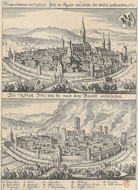
1631 stadtbrand von isny im allgäu
baroque
general charte der in den herzoglich bremen - und verdenschen aemtern und gerichten ottersberg, osterholtz, lilienthal, bremervörde, rotenburg und achim belegenen mööre, und der seit 1750 darin... - btv1b531196435
bibliothèque nationale de france
old maps of regensburg
baroque
general charte der in den herzoglich bremen - und verdenschen aemtern und gerichten ottersberg, osterholtz, lilienthal, bremervörde, rotenburg und achim belegenen mööre, und der seit 1750 darin... - btv1b531196435
bibliothèque nationale de france
general charte der in den herzoglich bremen - und verdenschen aemtern und gerichten ottersberg, osterholtz, lilienthal, bremervörde, rotenburg und achim belegenen mööre, und der seit 1750 darin... - btv1b531196435
bibliothèque nationale de france
general charte der in den herzoglich bremen - und verdenschen aemtern und gerichten ottersberg, osterholtz, lilienthal, bremervörde, rotenburg und achim belegenen mööre, und der seit 1750 darin... - btv1b531196435
bibliothèque nationale de france
engravings by matthäus merian
baroque
eran laor cartographic collection
willem albert bachiene
eran laor cartographic collection
willem albert bachiene
bibliothèque nationale de france
tranquillo mollo
carte generale du tres-haut, tres-puissant et tres chrestien royaume de france
bibliothèque nationale de france
carte generale du tres-haut, tres-puissant et tres chrestien royaume de france
bibliothèque nationale de france
carte generale du tres-haut, tres-puissant et tres chrestien royaume de france
bibliothèque nationale de france
bibliothèque nationale de france
tranquillo mollo
carte generale du tres-haut, tres-puissant et tres chrestien royaume de france
bibliothèque nationale de france
carte generale du tres-haut, tres-puissant et tres chrestien royaume de france
bibliothèque nationale de france
carte generale du tres-haut, tres-puissant et tres chrestien royaume de france
bibliothèque nationale de france
carte generale du tres-haut, tres-puissant et tres chrestien royaume de france
bibliothèque nationale de france
carte generale du tres-haut, tres-puissant et tres chrestien royaume de france
bibliothèque nationale de france
carte generale du tres-haut, tres-puissant et tres chrestien royaume de france
bibliothèque nationale de france
carte generale du tres-haut, tres-puissant et tres chrestien royaume de france
bibliothèque nationale de france
eran laor cartographic collection
willem albert bachiene
eran laor cartographic collection
willem albert bachiene
carte generale du tres-haut, tres-puissant et tres chrestien royaume de france
bibliothèque nationale de france
carte generale du tres-haut, tres-puissant et tres chrestien royaume de france
bibliothèque nationale de france
carte generale du tres-haut, tres-puissant et tres chrestien royaume de france
bibliothèque nationale de france
carte generale du tres-haut, tres-puissant et tres chrestien royaume de france
bibliothèque nationale de france
carte generale du tres-haut, tres-puissant et tres chrestien royaume de france
bibliothèque nationale de france
carte generale du tres-haut, tres-puissant et tres chrestien royaume de france
bibliothèque nationale de france
carte generale du tres-haut, tres-puissant et tres chrestien royaume de france
bibliothèque nationale de france
carte generale du tres-haut, tres-puissant et tres chrestien royaume de france
bibliothèque nationale de france
carte generale du tres-haut, tres-puissant et tres chrestien royaume de france
bibliothèque nationale de france
carte generale du tres-haut, tres-puissant et tres chrestien royaume de france
bibliothèque nationale de france
301 - 400 of 417
Next page
/ 5


![Wallia principatus vulgo Wales: Seren[issi]mo Domino Carolo Magnae Britanniae, etc. Principi [signé] Joh. Blaeu, 1673](https://cdn.creazilla.com/illustrations/10001204343/wallia-principatus-vulgo-wales-serenissimo-domino-carolo-magnae-britanniae-etc-principi-sign-joh-blaeu-1673-md.jpg)